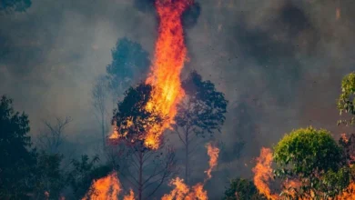
La Niña vs El Niño 2026: How the Pacific Is Reshaping This Year’s Weather
Weather patterns are shifting as La Niña vs El Niño changes global rainfall and heat. Learn what it means for your region.

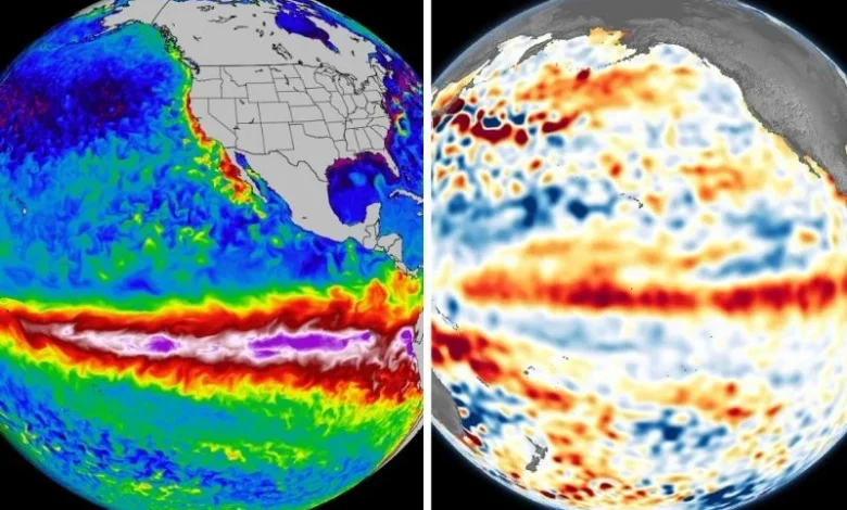
The year started with a mild La Niña already underway, but by June 2026 the Pacific had flipped into a strengthening El Niño. The single shift in the ocean is now reshaping rainfall, heat and storm patterns across continents, and it matters far beyond weather forecasters and scientists.
What Really Happened in the Pacific This Year
The start of 2026 saw slightly cooler-than-average sea surface temperatures in the central Pacific, which indicated weak La Niña conditions. By spring the ocean was in a neutral phase, neither warm nor cool. Then from May through June, warm water emerged from below the surface and spread eastward, raising temperatures above the threshold for El Nino. NOAA’s Climate Prediction Center made it official in June, issuing an El Niño Advisory and saying there’s a very high chance the pattern will strengthen through the rest of the year.
Why This Swing Is Important to the Common Man
La Niña and El Niño are opposite sides of the same natural cycle, each altering the wind and rainfall patterns in different ways:
•Years of La Niña are typically associated with wetter conditions in Southeast Asia and Australia and drier conditions in parts of South America and the southern United States.
•That usually flips in an El Nino year, with drought risk in Southeast Asia, the Amazon and southern Africa, and heavier rain in parts of South America and the southern US.
•A mid-year flip, like the one in 2026, can catch farmers, fisherfolk and city planners off guard as seasonal habits based on one pattern suddenly stop working.
Who gets it first?
Farmers timing planting seasons, fisherfolk watching ocean temperatures, and city water managers watching reservoir levels are usually the first to notice a Pacific shift, often before it shows up in daily weather reports. Coastal communities also keep a close eye, as El Niño years have been historically associated with weaker monsoon rains in parts of Asia and a more active hurricane season in some Pacific areas.
How long this El Nino may last
The odds of El Nino persisting into the winter of 2026 into early 2027 are now well above 90 percent, according to forecasters, with a real chance it ramps up into what scientists call a “very strong” event before it hits its peak. That means the above effects are not a short blip. This pattern is likely to affect areas that depend on predictable seasonal rain, from the rice-growing deltas of Asia to the farmlands of southern Africa and South America, for weeks into next year, not just a few weeks.
Conclusion
La Niña will be replaced by El Niño in 2026, a reminder that the Pacific Ocean, distant for most of us, is a silent conductor of global heat and rainfall. Knowing which phase the world is in means farmers, coastal communities and everyday households can plan a little further ahead. The Pacific has changed its mood this year and is worth watching.
Track the latest climate changes.
Is Your Seafood Becoming Riskier?
Find how El Niño affects ocean pollution.
Why Are Heatwaves Getting Worse?
Check out the link between monsoons and El Niño.
What Happens During Super El Niño?
See the major weather changes ahead.
Could Food Prices Rise Soon?
Uncover how climate affects grocery costs.
How Will Weather Patterns Change?
Get to know this summer’s biggest climate shifts.