Himalayan Disaster Risk: Why Melting Glaciers Are Making the Mountains More Dangerous

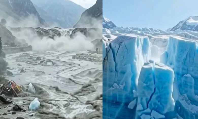
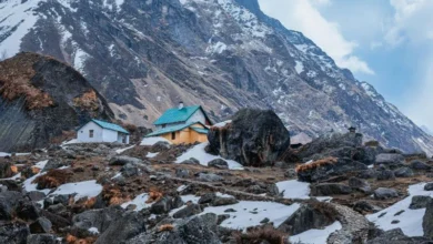
Something is shifting high up in the Himalayas, and it’s not slow or subtle anymore. Heat is chewing through ancient ice, mountain lakes are swelling past their old banks, and slopes that stayed frozen for centuries are starting to give way. Himalayan disaster risk, When a slab of glacier breaks off or a rock face collapses, the fallout doesn’t stay local, it can tear through towns hundreds of kilometres away within hours. That’s why Himalayan disaster risk has become one of the more pressing climate stories the world needs to pay attention to right now.
Why Glaciers Are the Root of the Problem
Glaciers across the Himalayas have been losing ground for years, and that retreat leaves a mark. As ice pulls back, it carves out hollows that fill with meltwater, either forming new lakes or stretching out old ones. Here’s the catch: many of these lakes aren’t held in by solid rock. They’re propped up by loose piles of debris called moraine. When that barrier buckles, what follows is a fast, forceful release of water that nobody downstream saw coming.
What Is a GLOF and Why Does It Matter?
Scientists call this a glacial lake outburst flood, or GLOF, and it happens when a mountain lake breaks through its natural dam with almost no notice. These floods don’t just carry water, they drag along tons of rock, mud and debris, hitting far harder than an ordinary rain-fed flood. Some recent events have shown GLOFs teaming up with landslides, turning a mountain hazard into a full-blown disaster striking communities nowhere near where the trouble actually started.
Why Downstream Communities Are Most at Risk
- Villages often sit in tight river valleys with barely any escape route once water rises
- Warning networks in remote, high-altitude terrain are still thin, so alerts arrive too late
- Rivers cross borders, and flood data from one country doesn’t always reach its neighbour fast enough
- More roads, homes, and hydropower projects near riverbanks put more lives directly in the flood’s path
What Can Reduce the Danger
Stronger monitoring is the clearest way forward. Weather stations, water-level sensors, and satellites tracking glacier movement can buy communities those crucial extra hours. But technology alone won’t cut it, countries sharing a river need to actually talk to each other, since a flood starting in one nation often becomes somebody else’s emergency.
Quick checklist for anyone living in or travelling through mountain regions:
- Find out if your area sits in a valley below a glacier or high-altitude lake
- Follow local disaster alerts and any official flood warning apps
- Keep emergency numbers saved and a go-bag ready during melt season
- Join community-based warning drills whenever offered
- Avoid building or camping too close to riverbanks in glacier-fed valleys
Conclusion – Himalayan disaster risk
This isn’t a problem tucked away in remote villages. Himalayan disaster risk reaches millions downstream, across borders and seasons. Better monitoring, faster data sharing, and aware communities together give people their best shot at staying ahead of mountains that no longer behave the way they used to.
Track the latest climate changes.
Is Your Seafood Becoming Riskier?
Find how El Niño affects ocean pollution.
Why Are Heatwaves Getting Worse?
Check out the link between monsoons and El Niño.
What Happens During Super El Niño?
See the major weather changes ahead.
Could Food Prices Rise Soon?
Uncover how climate affects grocery costs.
How Will Weather Patterns Change?
Get to know this summer’s biggest climate shifts.