
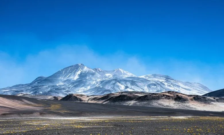
There are deserts where it doesn’t rain much, and then there’s a place where some meteorological stations haven’t had a drop in their entire recorded history. That’s the Atacama Desert snow in northern Chile. So satellite images from August 2026 showing large parts of it buried under snow caught even scientists who study this region off guard.
Here’s Why the Atacama Desert’s Snowfall Was So Rare
Snow isn’t totally unknown here. It was in 2011 and 2025. But this time was not the same. NASA’s Landsat satellites took images showing snow covering nearly the entire distance from the Andes mountains down toward the Pacific coast, land that can go years, sometimes decades, without seeing rain or snow of any kind.
It was a thing called a cutoff low—and that was responsible. Think of it as a pocket of cold air that splits off of the main jet stream and cruises along its own path. This one in particular broke away from a massive low-pressure trough that stretched across a large swath of the Southern Hemisphere, pulling in much more moisture than the area normally sees this time of year.
Towns Taken By Surprise and Telescopes
There’s a reason astronomers flock to northern Chile: Its clear skies and dry air make it one of the best places on Earth to study the universe. That’s exactly why the ALMA radio telescope was built there. But during these storms, the telescope had to go dark, putting its antennas into a protective mode just to survive the snow and wind.
Down near the coast things got even messier. The town of Taltal was deluged with almost 40 millimeters of rain in three days. To put that in perspective, that’s about ten times what the town normally gets in an entire year. The result was mudflows and flash flooding that damaged hundreds of homes, enough to prompt Chile’s disaster response agency to declare a state of emergency in several affected regions.
El Niño Link
Scientists studying the event keep coming back to one thing: a strengthening El Niño.During El Nino years the high-pressure system that normally keeps the Atacama dry is weakened. And to top it off, storm tracks are moving closer to the equator than normal. Combine those two things and suddenly you’ve got a moisture-heavy storm system with a real shot of hitting a desert that rarely, if ever, sees one.
What this means for the future
•Even the driest parts of the Earth can’t escape flooding.
•Buildings and roads in dry places often are not designed to withstand sudden rain.
•In El Niño years, weather monitoring in vulnerable areas needs to be more closely watched.
•Satellite data is proving critical in tracking these fast-moving extremes.
Conclusion – Atacama Desert snow
What happened in the Atacama in 2026 isn’t just a strange weather story; it’s a sign that extreme climates can still surprise us and that places built around the assumption of endless dry weather may need to start planning for the rare storm that breaks the pattern.
Track the latest climate changes.
Is Your Seafood Becoming Riskier?
Find how El Niño affects ocean pollution.
Why Are Heatwaves Getting Worse?
Check out the link between monsoons and El Niño.
What Happens During Super El Niño?
See the major weather changes ahead.
Could Food Prices Rise Soon?
Uncover how climate affects grocery costs.
How Will Weather Patterns Change?
Get to know this summer’s biggest climate shifts.