Florida Flood Risk Rising as a Week of Rain Threatens to Beat October’s Monthly Average

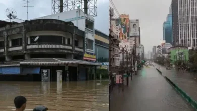
If you’re in Florida this week, an umbrella alone won’t cut it. A stalled weather front is set to dump close to a month’s worth of rain on parts of the state in under seven days, and forecasters aren’t ruling out flash flooding. The growing Florida flooding risk concern has pushed local officials, from the Panhandle down through North and Central Florida, to tell people to get ready now, not after the first warning siren goes off.
What’s Behind This Sudden Burst of Rain
Here’s the mechanics of it. A slow-moving cold front has tapped into tropical moisture drifting up from Central America. Normally a front like this would move through and clear out within a day or two. This one hasn’t. It’s gotten pinned between a stalled boundary and a strong area of high pressure sitting to the north, and that’s what’s keeping the rain parked over the same stretch of Florida for days on end. So this isn’t your usual quick-hit afternoon storm pattern. The same towns are getting soaked again and again, and the ground is running out of room to absorb it.
Where the Flood Risk Is Highest Right Now
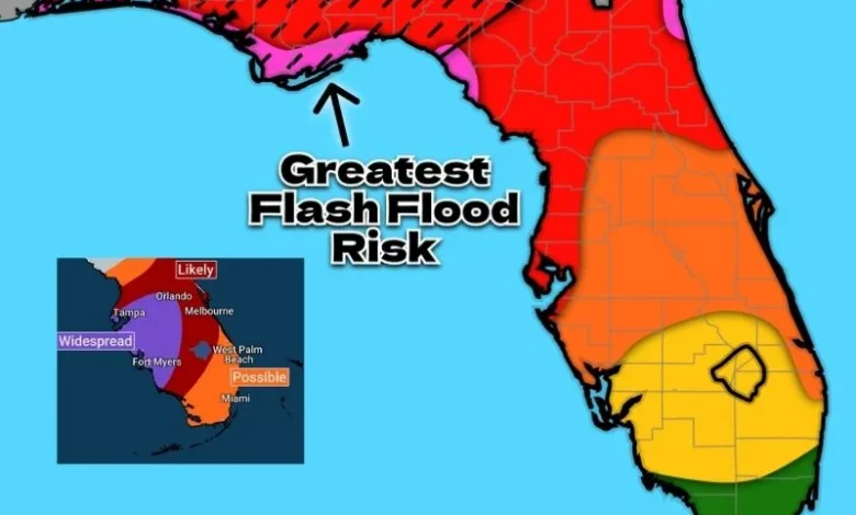
The worst of it looks to be lining up near the Panhandle and North Florida, running from Jacksonville down to Tampa. Some spots could see 5 to 8 inches of rain before this is over, which is close to, or more than, what those cities normally get across the whole of October. A Level 1 out of 4 flash flood threat is already in effect for several days this week, and officials have said plainly that this could get bumped up once the models firm up a bit more.
The Odd Upside to All This Rain
There’s a strange silver lining buried in this story. More than half of Florida has been sitting under moderate drought or worse for months now. The very same system threatening flash floods this week is also expected to chip away at that drought in a meaningful way. It’s an odd pairing, a genuine hazard and genuine relief showing up together, and while emergency crews will be watching the roads, water managers won’t mind the rain filling back up what’s been missing all year.
A Few Practical Steps Worth Taking
If you’re in the path of this, a little prep goes a long way. Here’s what’s worth doing before the heaviest rain hits your area.
- Turn on emergency alerts on your phone so flash flood warnings reach you the moment they’re issued
- Never drive through standing water, even a few inches can float or stall a car
- Clear out gutters and storm drains near your home so water has somewhere to go
- Check your county’s emergency management page for the latest shelter and drainage updates
- If you’re in a spot that’s flooded before, move valuables and important papers up off the floor now
Conclusion – Florida flooding risk
What’s happening in Florida right now is a good reminder that floods don’t always need a single dramatic storm to cause trouble. Sometimes it’s just rain stacking on rain, day after day, until the ground simply has nowhere left to put it. Keep an eye on the alerts, stay off flooded roads, and let this system do its slow work of easing the drought while everyone rides it out safely indoors.
Track the latest climate changes.
Is Your Seafood Becoming Riskier?
Find how El Niño affects ocean pollution.
Why Are Heatwaves Getting Worse?
Check out the link between monsoons and El Niño.
What Happens During Super El Niño?
See the major weather changes ahead.
Could Food Prices Rise Soon?
Uncover how climate affects grocery costs.
How Will Weather Patterns Change?
Get to know this summer’s biggest climate shifts.