
NISAR Satellite Films Rare Volcanic Eruption, Opening New Era in Disaster Tracking

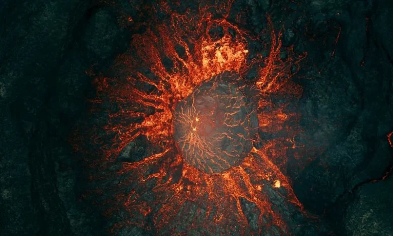
For A volcano on Russia’s remote Kamchatka Peninsula had been quiet for nearly five centuries. NISAR satellite tracking, Then, in summer 2025, it erupted. But this story is not only unique because of the eruption, but because of how it was recorded. A joint mission between the United States and India has produced a detailed time-lapse video of the event using radar, giving people around the world a fresh way to watch the planet change in real time.
What Happened at Krasheninnikov Volcano
In July 2025, a powerful 8.8 magnitude earthquake struck near the Kamchatka coast. Just days later, one half of the Krasheninnikov volcano pair began erupting for the first time since around the year 1550. Lava started flowing steadily eastward, filling smaller craters before spreading outward like a slow river of fire.
This is where the NISAR mission comes in. Standing for NASA-ISRO Synthetic Aperture Radar, the satellite is a joint project between America’s space agency and India’s ISRO. It orbits nearly 750 kilometres above Earth and has been quietly gathering radar images of the eruption every twelve days since late December 2025.
How the Video Was Made
Researchers combined 17 radar images taken over several months into one continuous video. Unlike ordinary cameras, this satellite reads microwave signals rather than light, which means it can see through clouds, smoke, and even complete darkness. That gives it a real advantage in places where bad weather or remoteness usually blocks a clear view of what is happening on the ground.
Each pixel in the footage covers roughly ten metres by ten metres, about half the size of a tennis court. Lava shows up brighter in the images because it reflects microwaves differently than snow or bare rock, so the flow is easy to follow as it spreads.
Why This Matters Worldwide
- Natural hazards can now be tracked far more consistently, even in remote regions without ground sensors.
- The technology can monitor nearly 1,300 active volcanoes across the planet, many rarely studied before.
- It offers a possible model for early warning systems in countries with limited monitoring resources.
- It shows what two nations working together on satellite technology can achieve.
A Tool for Everyday Disaster Readiness
This technology sits far above our heads, but its impact reaches people living near volcanoes and fault lines everywhere. Better satellite monitoring means disaster agencies could get earlier warnings about eruptions or ground movement, which matters most in places where local monitoring equipment is scarce or costly to maintain.
Conclusion – NISAR satellite tracking
The Krasheninnikov eruption is a stark reminder that the Earth is always changing, and now, thanks to the NISAR mission, we have a better window into those changes than ever before. And as this radar technology continues to gather data, it may quietly become one of the most important tools for protecting lives near volcanoes around the world.
More stories on extreme weather.
Why Is Bangladesh Facing Flood Risks?
Find the latest climate insights.
What’s Driving India’s Weather Split?
Check out the extreme weather patterns.
Is Sonamarg Travel Safe Today?
Get to know the latest advisory.
How Severe Are China’s Floods?
Browse the latest emergency updates.
Why Is Northeast India Flooding?
Uncover the unusual jet stream effects.